3-d Aeronautical Chart - San Francisco
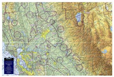
Артикул: 13-09596

16392 13660 руб.

Наличие: – Есть в наличии у нашего поставщика. Доставка на наш склад в течение 5...6 недель после оплаты Вами заказа.

Overview

This 3D FAA Sectional aeronautical chart covers the central California area from San Francisco to Reno/Lake Tahoe, and includes Yosemite and Mammoth.
The precisely molded 3D shape allows pilots to see and feel the terrain shape and clearly understand how it relates to the airspace and flight. Pilots will value referencing this chart for flight planning, training, and as a general conversation piece, whether hung on a wall of an office, hangar, or home. This chart is made with a digital inkjet printing process on a rigid plastic film, which is then molded to a precise terrain model.